Wednesday, December 29, 2010

The Blue Mountains

After heading back to Sydney with Erica and Stefania (a couple of Italian girls that we met in Adelaide) we decided to head up to the Blue Mountains for a couple of days of bushwalking.  After a two hour train ride from Sydney, we departed the train in Katoomba, our jumping off point.
After dropping our bags off at our hostel (as I’m now starting to resent every single item in my backpack), we headed down to the information centre to get some guidance on what walks we could do, and what sites we couldn’t miss.  Needless to say, the walks and sites are endless – which means I may have to make a return visit before I depart Australia because we couldn’t see it all.
The most photographed site in all of the Blue Mountains is the “Three Sisters”, a rock formation easily viewed from Echo Point.  The local legend is that the Three Sisters was created when a sorcerer turned three beautiful sisters into stone to protect them from the advances of three men.  Unfortunately the sorcerer died before he could reverse the spell, and there they rest.  Luckily it was sunny and clear, and I was able to get some decent pictures.


We did a quick walk in along the cliff face to the Katoomba Falls.  What was supposed to be an easy walk was turned quite challenging by the rain that had fallen the day before, turning parts of the path into a puddled, muddy mess.  Made even more challenging by the wearing of flip flops rather than actual walking shoes.  Lesson learned, and it was a good thing.


As an aside, that isn’t a smoky haze covering the mountain range.  The Blue Mountains are named the Blue Mountains because of the blue haze that is given off by the oils in the abundant eucalypt trees in the gorges.
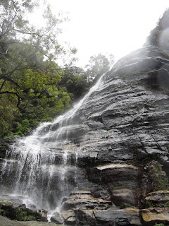
The next day, we set out on our really long hike, consisting of the Prince Henry Cliff walk, to the waterfalls, then down from very narrow and treacherous steps (a lot of very narrow and treacherous steps), along the bottom of the cliff face for 4km through a temperate rain forest, complete with ferns bigger than me, and rocks turned completely green with moss and lichen, until we came to the Furber Stairs – 1000+ stairs of pure torture back up to the top.  Silly me – I didn’t charge my camera the night before, and as a result it died about 1/3 of the way through our voyage, so I’m going to have to go back and get some pictures – in particular of the leeches that live in the forest.  They’re particularly adept at climbing up shoes and latching onto the first piece of skin they can find.  Gross.


Thursday, December 16, 2010

Megan’s Most Favorite Day So Far aka The Barossa Valley Wine Tour

As many people will attest, I enjoy the occasional glass of wine (or bottle).  White primarily.  I’ve never been able to develop a taste for Red.  So, when Chrystal and I settled in Adelaide for a spell, the number one thing on my list of things to do was a tour of one of the wine regions that surround Adelaide.  So, even though poor Chrystal is not a fan of the wine, she gamely agreed to come with me on a wine tour.


We boarded the bus in the morning, not really knowing what to expect, given that neither of us have ever been on a wine tour before.  We booked through a company called Taste of Barossa, which is a small operation, with incredibly personal service.  The plan was to stop at four Cellar Doors – McGuigan, Peter Lehmann, Langmeil, and Murray Street, with lunch included on the patio at Peter Lehmann.
As we made our way up through the Adelaide hills, I finally saw a Kangaroo in the wild!  We were going too fast to take a picture, but I now believe that they do exist in the wild, and are not in fact a mythical creature like a unicorn.
As we were driving through the valley, I couldn’t help but notice the number of rose bushes planted.  It turns out that this is actually for practicality as well as aesthetics.  Roses are more susceptible to diseases than grape vines, and as a result, the rose bushes were planted as an early detection system for disease. 
The Barossa Valley is known for the red wine that it produces, so consequently, 75% of the wine that we sampled was red.  And I think I’m a convert.  Particularly to the Sparkling Shiraz – which I’m told is an excellent breakfast wine.  (Note to self – bring a bottle home).

I'm finding it hard to put into words what we saw, so here is a sampling of the pictures.

The Whispering Wall - you can stand on one end and have a whispered conversation with the person on the other side.

McGuigan - pretty impressive for a cellar door.

Mmmmmm - so tasty.

A nice walk after lunch to the next Winery.

Ahh - a well cultivated grape vine.

These Grape Vines are the oldest in the world - over 160 years old and originated from Germany.  The 3 acres of vines produce 2 tonnes of fruit, from which comes some very excellent (and pricey) red wine.

Finally mastering the self portrait.

Rose bushes everywhere!

Saturday, December 11, 2010

The Great Ocean Road

As one of the people that I recently met in Australia put it “Australians aren’t the most creative at naming things.  We have an ocean road, and it’s a really great ocean road, hence we call it The Great Ocean Road”.  And let me tell you – it’s a really great road.
The Great Ocean Road starts about 400 km east of Adelaide, and winds its way along the southern coast of Australia towards Melbourne.  It’s touted as one of the most beautiful drives in the world, and they’re not lying.  We started early in the morning and made our way along the coast, pulling over at each and every look-out point we came to.  It’s hard to describe the roar of the surf, and the constant mist that hangs in the air.  At the end of the day, you’re covered in salt.  The cliffs are primarily limestone, and the constant pounding of the surf, and the wind, leads to some amazing rock formations.  Sadly, the majority of places where we were able to access the surf, it was too dangerous to swim – not that you’d want to anyway, the water is really cold.


The one rock formation that everyone talks about along the Great Ocean Road is the Twelve Apostles – twelve limestone pillars that stand in the surf.  Except now there are only eight Apostles.  The constant action of the surf has toppled four.  It’s interesting to stop at – every other named rock formation has a small parking area, and some gravel paths for you to access the viewing area.  The Twelve Apostles has its own visitor centre, and the paths are paved.  The viewing platform is grandiose.  And I personally found them to be some of the most over rated formations.  They’re pretty, but I found that some of the lesser visited sites to be more pristine and picturesque.


We continued on up the long and windy road – think right angle turns and switchbacks that make you white knuckled as you manoeuvre your very unresponsive campervan through them.  We decided to camp about halfway through our journey in the Otway National Park at a wonderful caravan park called Bimbi’s.  It is here that we finally saw the fabled Koala.  This resulted in my tramping through the fields and bushes, quite forgetting that everything in Australia is apparently able to kill you.  But I got some pretty good pictures.  And I can’t even begin to describe the growling noise that they make (apparently it’s mating season).


After a chilly night, we continued on down the road to the Otway Lighthouse, which has preserved all of the old buildings and homes used when the Lighthouse was the primary means of guiding the ships around the rocky shore towards Melbourne.  You are able to climb the lighthouse to see the view, which we did.  It was a little disconcerting to climb out and look down and see nothing but the rocky shore below. 
We made a couple of hikes out to some waterfalls, seeing another fabled Australian animal, the Echidna.  They’re primarily nocturnal, and very shy, so it was quite a surprise to see one.


Afterwards, it was a white knuckled ride along the rest of the Great Ocean Road.  The cliffs were on the left side, the long drop down to the open ocean was on the other side.  All I can say is thank god for slow driver turn out lanes, or else there would have been a riot by all of the faster cars behind me.   Next up – wine, wine and more wine.

Monday, November 29, 2010

Alice Springs to Uluru

Alice Springs to Uluru
I distinctly remember being around 10 years old, sitting in the basement and watching a PBS television program about the Australian Outback.  I was fascinated by the animals and the landscapes – in particular Ayers Rock (or Uluru to be more correct).  I can’t pinpoint exactly what it was about it that fascinated me so much, but it has stayed with me for a number of years.  So of course, it was a must see point on this journey.
As a jumping off point to start our trek out to Uluru, we spent two nights in the town of Alice Springs, the iconic outback town that really is the only base from which to start.  After 3 nights in the campervan, we splurged and checked ourselves into a hostel, complete with hot showers, and laundry.  It was off to the centre of town where we tucked into a nice meal – complete with Kangaroo medallions in a sauce of Outback spices.  Don’t ask me to describe what the taste was like – it tastes like Kangaroo.  But it was very good.  I spent the next full day wandering around Alice Springs, checking out the numerous Aboriginal art galleries, and funky little shops, and generally being lazy in the hostel common area.  Oh Steig Larssen – I resisted you at home, but the book swaps here landed me with the Girl with the Dragon Tattoo.  And I was essentially useless for the rest of the day.
The Todd River in Alice Springs.

The Todd River again - the only reason it has water in it is the result of an abnormally wet year that they've had in the outback.
We set off for Uluru the next morning.  A very long 450km later, we pulled into the Yulara Resort – which is the only place to camp within 150km of the park.  Early the next morning, we joined the caravan of cars heading out into the darkness, racing the sun to see it rise over the rock.  Sadly, we were thwarted by the clouds that rolled in!  It was still amazing to see, in the calm of the morning. 
Our view of Uluru from the look out point at the campground.

The flowers were blooming in the Red Centre! 
As I’m sure people are saying (because they were saying it before we left home)  “what’s all the fuss about a rock?”  Technically, it’s not a rock – it’s one of 3 surviving peaks of a mountain range.  It’s 3.6 km long, 2.4 km wide, and is 343 metres high.  It’s of incredible significance to the Anangu people, as its name means “Meeting Place”, and is home to many of the Dreamtime legends, which you can see depicted in carvings and paintings.  As such, there are a number of signs posted on the walk around the site asking you to not take pictures of the sacred sites, because only those of the Anangu who have been initiated into the secrets of the sacred can see these places.  (I tried to obey the signs and respect the wishes of the Anangu people, but if I inadvertently took a picture, I’m sorry.  Drop me a line and I’ll remove the picture)
We started our 10km walk around the perimeter of Uluru – we could see the clouds rolling in, and hear the thunder, but really?  Rain in the desert?  The answer is yes.  It poured down on us for probably a good 20 minutes until the clouds broke, and the sun came out.  It was magical to see the rock, red with the moisture, with the water running down in channels.
Uluru at Sunrise.

Finally - some sunshine breaks from behind the clouds.

Glo enjoying the sights!

The walk up to the top of Uluru.  It was closed due to winds and the possibility of rain.  We wouldn't have climbed it anyway.

Taking cover from the rain storm under a natural overhang at Uluru.  The water is running off the rock.

Our next stop was to head out an additional 50km to the Olgas (Kata Tjuta) which is a series of 31 individual domes or rocks that are in a semi circle which surrounds a central valley.  What is unique is that the entire site hides a number of water holes, which allows for some unique plant and animal life.  On one of our walks it was pointed out that there are species of plants that are completely unique to Kata Tjuta.  They aren’t found anywhere else in Australia.


Kings Canyon was the next national park on our list.  Opened in 1989, it’s a fairly new national park, and a welcome change from the crowds at Uluru.  Our plan was to drive out to Kings Canyon, do a couple of hikes to explore the scenery and landscape, and then camp for the night before starting our epic trek to the south.  In theory it sounded like a good plan, until we realized that the “Floodway” signs that we’d been seeing on our journey through the outback weren’t just there for show.  As more rain was forecast for that night, we did our hikes, and then made the wise decision to make for Kulgara back on the main highway and camp for the night.  Fairly good judgement on our part.


Floodway?  What's a floodway you ask?

Ahh, now I know.